
Hiking in Arayawangso Buddha Park, Kathu
Discover Tesarangsri Forest Monastery & Scenic Hiking Trails in Kathu

Arayawangso Buddha Park and the nearby Tesarangsri Forest Monastery offer both a peaceful place of worship and a rewarding hiking experience in a lush natural setting.
Located on the western slope of the Kathu Valley, in the heart of Phuket, this area remains largely unknown to visitors, making it ideal for those seeking a quieter, more authentic side of the island.
The hike begins near R.6 Waterfall, at the entrance of the Flying Hanuman zipline park, where parking is easy and safe. Starting early in the morning is highly recommended — not only to avoid the heat, but also to witness a serene Buddhist prayer ceremony often held nearby. Monks lead a group of devotees under a simple shelter, creating a calm and uplifting atmosphere that sets the tone for the hike ahead.

Arayawangso Buddha Park
Arayawangso Buddha Park is located on the slopes of Khuan Wa, the highest mountain in Phuket. A steep concrete road, approximately 1.5 kilometers long, cuts through the park and serves as the main hiking path. The ascent can be challenging, but it is well worth the effort.
In the early morning light, the surroundings take on a mystical quality. Large trees wrapped in saffron monk robes line the path, creating a spiritual ambiance that feels both quiet and timeless.

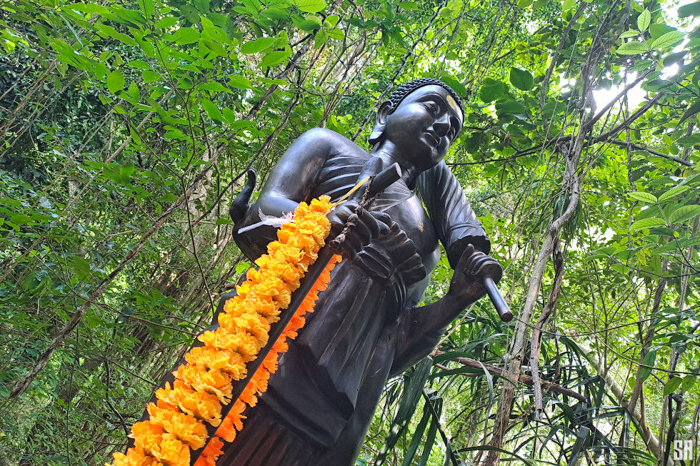
Along the way, you’ll encounter several Buddhist statues, including a walking Buddha, a seated Buddha sheltered by a Naga serpent, and a monk figure resting on a rock by a small stream near the monastery. At the top of the park stands a large seated Buddha statue, marking a symbolic endpoint — although the trail itself continues beyond.

The Coastal Trail Between Patong and Kamala
Beyond the main Buddha statue, the concrete road continues uphill past a few hillside homes before turning into a wide dirt track, accessible mainly to 4WD vehicles. This section of the hike is less steep and more relaxed, offering a completely different experience.
From here, you can enjoy elevated views over Patong, particularly above Phra Baramee Road on the northern edge of the town. As you follow the trail, multiple side paths branch off, leading down toward Patong, Kalim, and Kamala. The entire western mountain range of Phuket is crisscrossed with trails, forming a vast network that adventurous hikers can explore.

Continuing along the coastal ridge, the path eventually leads to Kalim Viewpoint, where a quiet bar-restaurant overlooks Patong Bay. While it is possible to hike all the way to Kamala, this route can be long and requires good navigation. On previous explorations, trails from this area have also led to waterfalls such as Kathu Waterfall, as well as Bang Wan and Bang Max waterfalls near Kamala.


Highlights
The route to the large Buddha statue, which marks the end of the Buddhist park, is on a paved road.
The park's forest is absolutely magnificent.
The views southward on Patong Beach are great

Heads Up
The slope is steep and a certain level of fitness is required to climb it.
The hike between R.6 Waterfall and the Big Buddha is approximately 1.5 km.
Allow an additional 1 km to reach the viewpoint overlooking Patong Beach.
Bring a picnic and plenty of water if you plan to continue to the Kalim viewpoint, which is 2 km further on.
Best Time to Go & Hiking Tips
The best time to hike in Arayawangso Buddha Park is early in the morning, ideally starting around 7:00 AM. Temperatures are cooler, the light is softer for photography, and the peaceful atmosphere — sometimes enhanced by nearby Buddhist ceremonies — makes the experience even more special.
Wear proper hiking shoes, as the concrete path can be steep and slippery, especially after rain. Bring enough water, as there are no facilities along the way. A hat and sunscreen are also recommended once the sun gets higher.

If you plan to explore beyond the Buddha Park, consider using a GPS app or offline map, as the network of trails can be confusing. While the main route is straightforward, side paths can quickly lead you deep into the hills. Finally, always be respectful when passing through temple areas: dress appropriately and keep noise to a minimum to preserve the calm, spiritual environment.
Arayawangso Buddha Park Photos




Arayawangso Buddha Park Map

Passionate about photography since the mid-2000s, I’ve spent years capturing the beauty of Phuket and southern Thailand — from beaches and islands to festivals and daily life. My work reflects a lasting love for the region and its ever-changing light.
Last visit & photos: Arayawangso Buddha Park — 7 June 2026


